Riding the new roads and thinking about exploring them, navigation is what escorts your journey and lands you in your desired place. Well, the days have sunk into oblivion when taking a map into your backpack was a necessary attribute of any motorcycle trip.
Paper maps are a comparatively slow and old way to find your way while cruising on uncharted roads. You'll need a quick means or source to take you directly to your chosen place, even with some extra information about your journey.
However, in this regard, a motorcycle navigation app would escort you on roads uncharted or unexplored. But, there is a huge collection of apps you’ll find in this regard. How would you decide to pick one of the best motorcycle navigation apps? However, to make your decision easy and convenient, we have listed down a few motorcycle navigation apps along with the features they involve.
Table of Content
1. What is a Motorcycle Navigation App?
A motorcycle navigation app is what escorts you and keeps you tension-free while exploring unknown roads. Let’s suppose you live in Massachusetts and want to explore the best motorcycle riding roads and destinations in California. Only a motorcycle navigation app can assist you well.
However, navigation is how users interact with the application and design and move from one interface item to another. For motorcyclists, the navigation system works as an assistant to let you know your direction in the shortest possible time and the fastest routes simply and logically.
2. Every Navigation App Should Have These Features
The Android Play Store and Apple App Store offer dozens of navigation applications, but how would you choose the most useful and convenient for you?
Some of the basic features that every rider should be aware of before selecting a motorcycle navigation app are listed below.
- Maps: The most important thing about a GPS navigator is that your maps are up-to-date so that there are all the new streets, new roundabouts, and changes in the road.
- Offline: That allows us to download your maps and operate without a data connection, so we can continue using the application without coverage.
- Traffic: The GPS navigator informs us about traffic jams and accidents to avoid the dreaded retentions.
- Speed alerts: These notify us of changes when we have exceeded the speed limit on the road.
- Radars: Are used to inform us about the presence of fixed or mobile radars.
- Alternative routes: We can decide which alternative route to take to reach our destination.
- Stops: Being able to pinpoint several stops in different directions before reaching your destination.
- Modes: Different ways to move to our destination: car, motorcycle, public transport, walking, bicycle, etc.
- Route options: To highways, avoid tolls, unpaved roads, etc.
3. What is the Best Motorcycle GPS Navigation App?
According to the features of the best motorcycle navigation app, Scenic is the one that fulfills the requirements of any rider.
3.1 Scenic: GPS and Navigation

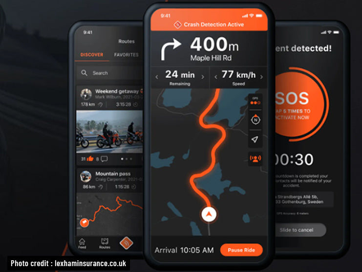
The Scenic motorcycle navigation app provides you with control over your ride. You can customarily plan routes and also choose stops and points to standby. If you don’t like a route, you can change it by choosing an alternative route mode, including curvy.
It includes the ability to unlock epic rides and is supported by a vast database of thousands of beautiful routes shared by the scenic community around the world. Just simply select an area, tap "search," and see what comes up.
Another way to select a ride or plan a route is by adding the distance. That's all that you need to do. The scenic route planner will direct you to the most suitable route and will locate you using GPS.
On-screen instructions, customizable detours, and voice navigation allow you to just focus on the road instead of tracing your location on the map. You can easily access the app while riding, as the scenic is designed to work seemingly with touch-enabled gloves.
It splashes your worries away with its offline mode. If you have no data reception, Scenic’s offline maps mean you can go where others turn back.
Except for navigating your ride only, Scenic also logs your location, current speed, and elevation so you can relive every moment and stay focused on the road.
Additionally, you can share your riding experience and also the app experience with the other riders in the app. You can also get a personalized web page of all your routes and rides, or share your journey straight on social media. But if you do not like the Scenic motorcycle navigation app, we found eight other great navigation apps for iOS and Android users as well.
Here are the 8 best motorcycle GPS navigation apps:
4. Best GPS Navigation Smartphone Apps
4.1 Google Maps
Of course, we begin our comparison with Google Maps, the most widely used GPS and navigator on iOS and Android, and the best alternative for various reasons. It has a very minimalistic interface, which makes it very easy to use, and it has voice navigation, which allows you to use it without having to touch the screen.
Its maps are updated daily to keep you informed of the latest road situations. It allows you to download regions, share your location in real-time, add stops, see alternative routes while driving Google, avoid being late to your destination thanks to real-time traffic information, and much more.
Google Maps earns the title of free motorcycle navigation app as well. Its database consists of 220 countries in the world. Moreover, Google Maps also provides you with a description of the quick paved and unpaved routes and their exact following for both pedestrians and motorists.

This motorcycle navigation app for smartphones also offers a description of more than 100 million different places, and it calculates how long it takes to overcome a given route and takes into account traffic jams.
You can quickly obtain information about any object, view a map from a satellite, and use 3D models; the Street View function will assist you in quickly navigating in an unfamiliar location and determining the route's final destination.
4.2 Sygic: GPS Navigation and Maps
It is a well-liked motorcycle navigation app with a lot of positive user feedback. Therefore, it is available for free. There are certainly paid extras that increase the functionality of the service; therefore, it is available for free.
The program is based on TomTom cards, which can be saved in the device's memory or on an SD card, eliminating the problem of navigation in the absence of the internet. This app's database includes 160 nations and locations, as well as information on attractions, a route-planning feature, and three different possibilities. The user is also alerted to traffic congestion and toll highways.

A more advanced version of the software is available from the developers, which offers extra functionality. As a result, the user will be able to use 3D maps, receive prompts for reconstructing at difficult crossroads, hear speech compounds while navigating, and be warned about the presence of speed cameras and where you need to slow down.
Sygic is the most downloaded alternative to Google Maps in the Play Store. It is a free GPS navigator, but there are some paid features, such as traffic information, voice directions, or some of its maps. They allow us to test all its functions for seven days.
4.3 HERE WeGo: Maps and Navigation
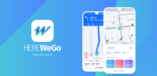
Next, we have HERE WeGo in our list, which a few years ago was the Windows Phone mapping application. Later on, Nokia sold its mapping services to a consortium consisting of Audi, BMW, and Daimler.
Here WeGo is a totally free motorcycle navigation app and the best alternative to Google Maps. It has a very careful interface that allows you to download your maps by continents, countries, or indigenous communities, and it has traffic information and speed alerts.
Therefore, what it does not allow is to add stops, share our location in real-time, or see speed cameras. Of course, its maps are updated 4 times a year.
4.4 Maps.Me: Offline Maps, Travel and Navigation
Alike Sygic, Maps.Me is another most downloaded alternative GPS navigator, free, with five navigation modes, and uses OpenStreetMap maps, which are updated every day.
This motorcycle navigation app allows riders to download maps by country and by indigenous communities. However, it does not have speed alerts, but it does have speed camera warnings. It also does not offer alternative routes, and its points of interest are few.
To make your commute easier, Maps.Me also provides offline services without requiring an internet connection. It helps you to find your way in areas where there is no internet connection at all, or it is very expensive (for example, roaming).
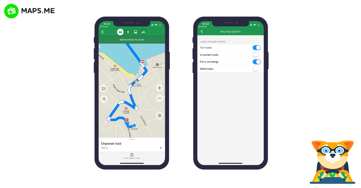
The application offers maps of the whole world, but the rider can only download those that will be used in order not to overload the device’s memory. Except for the information about maps and roads, this app also contains photographs of many places and attractions, which riders add by themselves.
Maps.Me helps to build a route for both motorcyclists and pedestrians. It searches for the desired object from 120 different categories, including medicine, food, museums, restaurants, entertainment, etc. Also, developers are constantly improving and updating the application, adding more and more useful features to it. Its interface deserves special praise: it is very convenient and thoughtful. The application is a real find for any rider.
4.5 OsmAnd: Offline Maps, Travel and Navigation

OsmAnd Maps provides OpenStreetMap maps, which are updated hourly to ensure they are always up to date. Users can use the app to get directions, browse offline maps, alter maps, log their trips, search for nearby locations, and view street-level imagery for more precise guidance.
Unlike many other navigation apps, OsmAnd lets you view accurate terrain data, making it easier to plan off-roading routes. The app includes other unique features, like a radius ruler and a compass, to make measuring distances easy, and users can easily share their locations with their friends.
The application, with high accuracy, determines the user’s location and paves the way for motorists, pedestrians, and public transport. However, there is a line of heights to determine the distance accurately. Routing over medium distances is carried out without access to the internet. Also, there are additional layer maps that can be superimposed on the main map.
There is a tool that allows you to search for addresses and other important items without having to use the internet. Voice commands are also available. When driving on a route, there are warnings about exceeding the permissible speed, etc.
4.6 Waze: GPS, Traffic Alerts, Maps, and Live Navigation

Another popular motorcycle navigation app for Android devices has positive user reviews. Developers made this app with the social navigator interface. In addition to standard maps and navigation, there is an opportunity to unite in a single network with the drivers of your region in order to provide and receive up-to-date information about the state of the road: traffic jams, police, prices at particular gas stations, accidents, etc.
Waze, affiliated with Google, is a GPS navigator that stands out for its large community of riders who share traffic and road information in real-time. It is unrivaled in traffic alert information.
Its maps are identical to those of Google Maps, which means they are constantly up to date, but with the added benefit of displaying more information regarding traffic accidents. We'll have speed camera warnings and speed alerts here. You can also arrange for your rides to be shared with your pals. It can't be used offline, which is the only drawback. Waze, like Google Maps, is a completely free app.
The route of movement is selected so that you cannot get into a traffic jam. Also, along the route, you will be able to receive alerts about the situation on the road, in addition to the basic navigation tips.
Apart from other key features, Waze also functions as a social app. It allows riders to stay in touch with their friends while also providing notification features to share their location and expected arrival time. Moreover, it can be synced with other social applications like Facebook. You can also add friends from other social platforms to increase the rating for adding information about traffic incidents. The application also suggests the cheapest refueling along the route. Therefore, developers keep introducing new advanced features and constantly updating maps.
4.7 CoPilot GPS, Navigation and Traffic
CoPilot is another paid motorcycle GPS navigation app that you can try for free as it currently offers a 14-day trial. After completion of the free trial, you’ll lose access to some useful features like voice-guided navigation, map downloading, and real-time traffic until you pay for it.
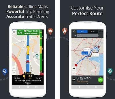
The browser of this navigation app is the one that least updates its map, once or twice a year. However, the download of maps is by continents and countries and allows the riders to calculate the fastest or shortest route.
4.8 MapFactor Navigator: GPS Navigation and Maps
The final app on our list is MapFactor, another navigation app with a high download rate and highly rated GPS browser in Google Play, but unfortunately, it has the worst user interface of all of our collection.
MapFactor Navigation's base version is free but has several premium options like real-time traffic, alternative payment routes, etc. Its maps are downloadable by country or state and updated every day.
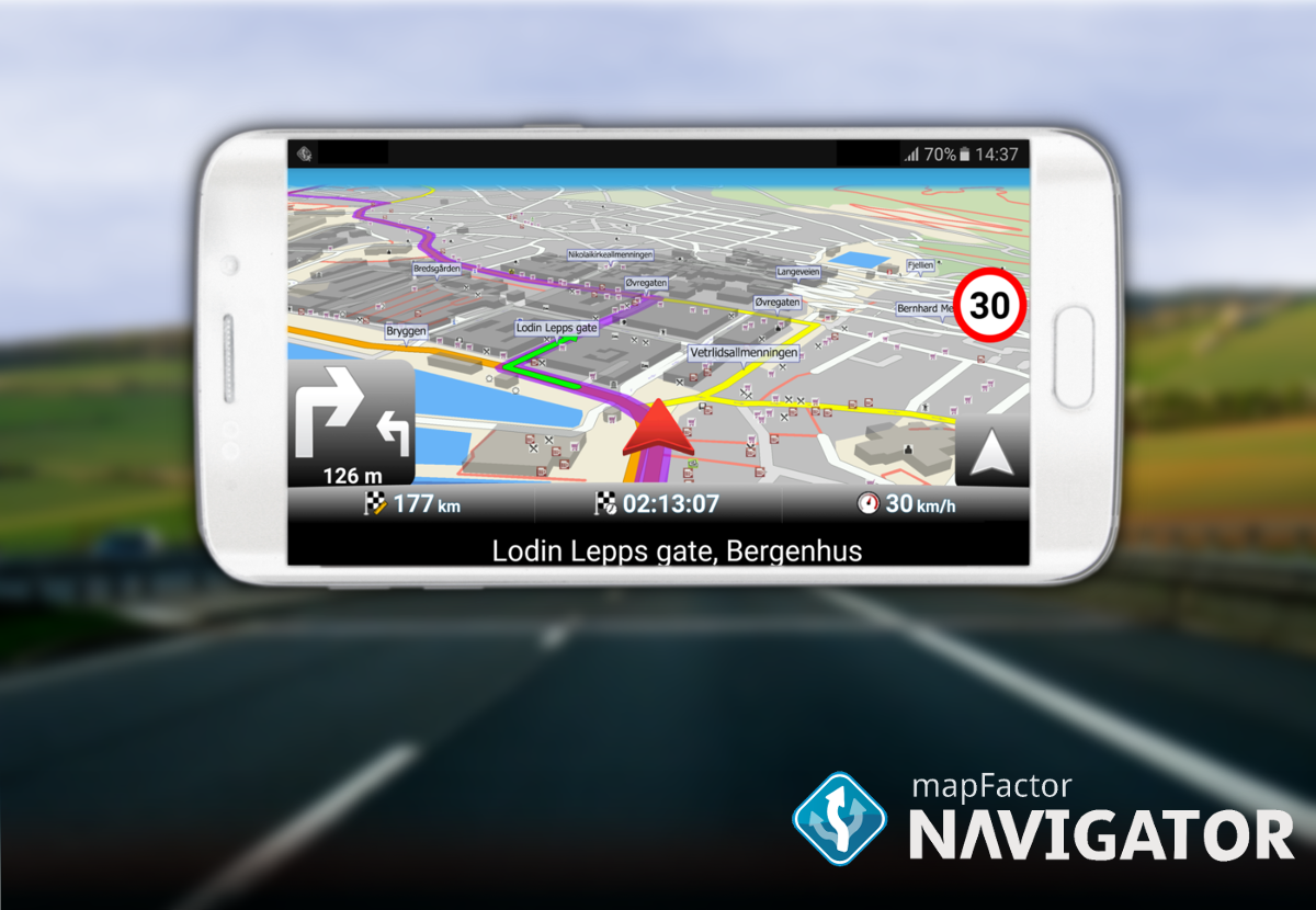
Moreover, this motorcycle navigation app also allows you to buy TomTom maps. It has speed radars. warning alerts, and blocks certain streets. Apart from motorcyclists, this app also supports big vehicles with its truck mode.
4.9 What is a Good GPS App for a Bike Messenger?
Google Maps is considered a great GPS app for bike messengers and many other modes of transport. Bike messengers can utilize it to travel on designated bike routes or find flatter routes with fewer steep hills.
4.10 Is there Any App to Find Other Motorcycle Riders in Your Area?
Eat Sleep Ride is one of the best motorcycle navigation apps that includes additional features for a smoother ride. When you are on the road, ESR can help you see other nearby riders who are using the app and easily get in touch with them.
4.11 How to Navigate Using Just Your Smartphone on Your Motorcycle
Above in this article, we have listed the best motorcycle GPS navigation smartphone apps for riders. All of them are easily available and accessible on your devices.
All you have to do is to download the most suitable app on your mobile phone and sync it with your social media profile. By doing that, you can easily access the app’s community to get to know the best riding roads and destinations within the state or other states as well.
Moreover, you can ask other riders from the community to get an idea of the motorcycle laws and licensing in all the states.
4.12 How to Use the Navigator on Your Smartphone?
- First and foremost, make sure that the navigation function is supported by your phone model. If your phone is an older model and you don't have this app, you'll have to get a new one.
- Download the application on the website or in the store, install it, and then you need to launch it. You'll notice various options when you first start: find an address, follow a route, look for a deposit, and so on.
- If you need to find a specific establishment or address, you need to enter it – and the application will find the way for you.
- If this is your first time using the navigator, then practice with the nearest address, and you will see how it works.
- After entering the required address, the device will give you voice prompts about where you are going and where you need to turn.
- All you have to do is to pay attention because the gadget can adjust the course to the appropriate location if you turn in the incorrect direction.
- You can find a shortcut to the desired place yourself. You can also choose the voice navigator feature that will notify you.
- If you need to stay at a restaurant or store, you need to select a location search and the navigator will find all suitable places nearby.
5. Best Offline Motorcycle Navigation Apps
In order to deal with the other possibilities, let’s take a look at some of the best offline motorcycle navigation apps, that are capable of performing their functions without an internet connection.
Which Motorcycle Navigation App Works Without the Internet?
5.1 Navitel
Navitel contains offline maps for many countries, which makes it an excellent navigation program with advanced functionality. Unfortunately, the app is paid. However, you can use it free for a certain period of time after the first installation, and perhaps this will be enough for the entire trip.
You now know how to turn an average Android smartphone into a full-fledged navigator and avoid getting lost in strange territory. If you desire to go to the famous motorcycle camping destinations in America, you can go on a motorcycle camping tour without any fear of going out to track. Above all, this app will navigate without an internet connection.
5.2 Google Maps
This utility is installed by default on a huge number of devices and can work in two modes: online and offline. These maps, which allow you to navigate in any area, are one of the best navigation options for Android. The application archive contains maps of almost all the places on the planet: many countries and individual corners where the most daring travelers go.
5.3 How Does the Offline Motorcycle Navigation App Work?
Usually, offline motorcycle navigation apps come with the option of saving offline maps and routes, like Google Maps. These apps come up with the default maps of the region or states and keep updating them whenever you go online. So, if you do not have access to an internet connection, you should simply utilize the saved maps for commuting.
Waze or Google Maps: Which Navigation App is Best for You?
Both Google Maps and Waze have positive aspects as well as flaws. Google Maps appears to be more reliable, accurate and has better real-time traffic than Waze, which has a larger army of fans who think the app is fantastic and enjoy the voice prompts feature. Updates, on the other hand, caused problems for both applications.
| Waze Pros and Cons | |
|---|---|
| Pros | Cons |
| Accurate real-time traffic updates | No public transportation |
| Find nearby gas stations | No offline use |
| Real-time route adjustments | |
| Google Pros and Cons | |
|---|---|
| Pros | Cons |
| Offline maps | Not ideal for off-road mapping |
| Shows all nearby locations | |
| Real-time traffic updates | |
6. Parting Words
When choosing a navigation app for your smartphone or tablet, consider the circumstances in which it will be used: excursions across the country or overseas, over huge cities, or to rural locations. You should choose an application that works with or without the Internet depending on this. Additional functionalities should not be overlooked because they are frequently quite valuable.





Leave a comment
All comments are moderated before being published.
This site is protected by hCaptcha and the hCaptcha Privacy Policy and Terms of Service apply.